If you followed along with my “live updates” from the Mar, you’re aware that I encountered some route changes to the Mar. (Or, perhaps, discovered where the route was actually supposed to be going in the first place.) I’ve finished updating the gpx tracks for the Mar; within a short time, they’ll be uploaded to the Cicerone book page. For now, though, here are some quick-and-dirty maps to help you visualize what has changed (click for full size):
Stage 2 – Towards San Cosme de Barreiros
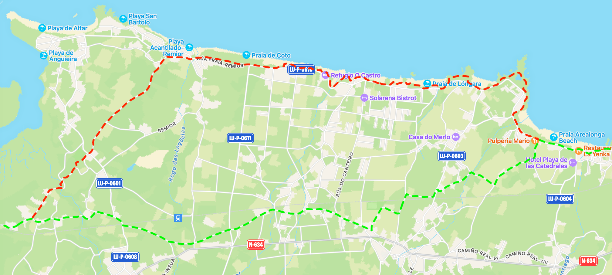
Whereas the Mar used to head south immediately after Praia as Catedrais, it now veers inland further west, near the end of Praia Arealonga, and then follows a more southwestwardly approach. It’s all paved, but it does bring you past an Eroski supermarket, which is mighty handy. In this map, the revised “official” Mar is in green, while the Cántabrico is in red.
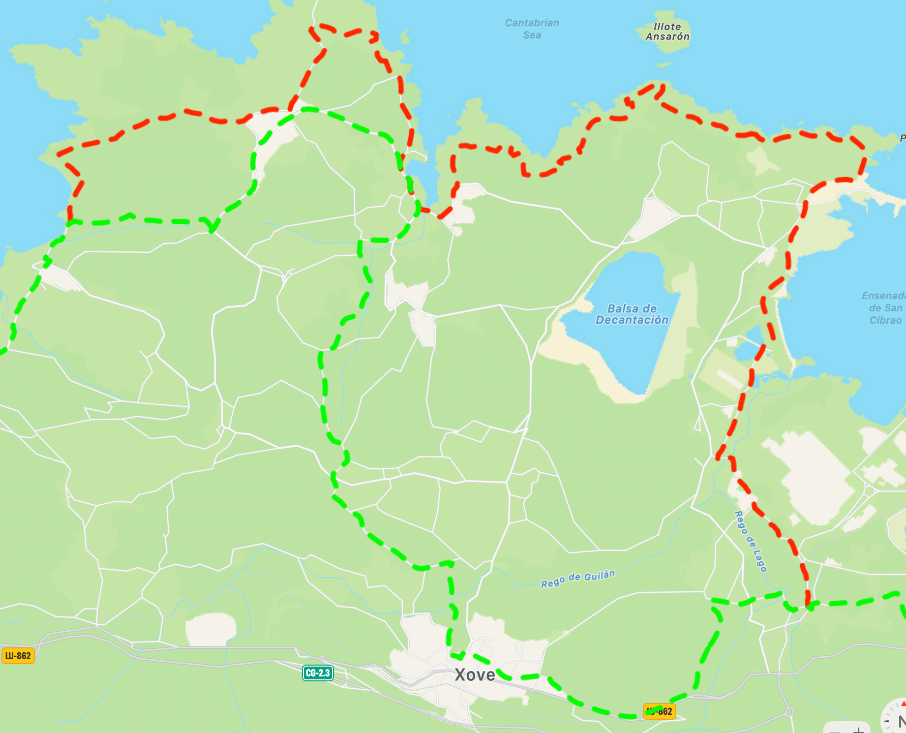
Stage 4 – The Mar Now Passes Through Xove
It’s quite the wiggly route, going south, west, north, briefly east, north, west, south… well, you get the idea! There’s not much difference in distance at this point between the Mar and the Cántabrico, and the scenery is much nicer on the latter. In this map, the revised “official” Mar is in green, while the Cántabrico is in red.
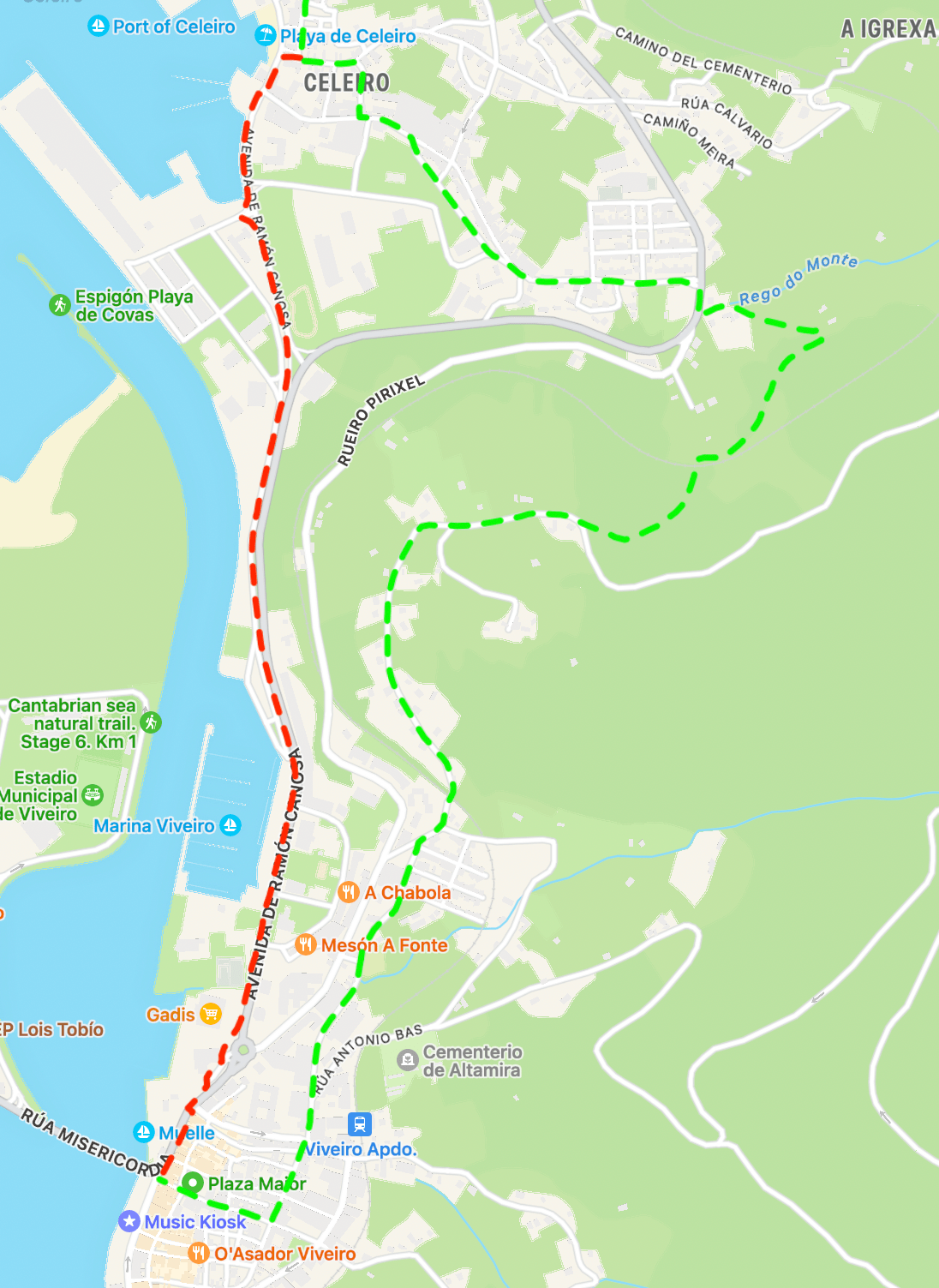
Stage 4 – Arrival in Viveiro
I had no idea that this longer, inland approach was official until Oliva at Oli Vita Hostel alerted me. The Cántabrico certainly isn’t great–there’s a longish highway stretch (with an ample sidewalk). I wonder how many people will have the juice for the Mar’s official approach, though, at the end of a long day! In this map, the revised “official” Mar is in green, while the Cántabrico is in red.
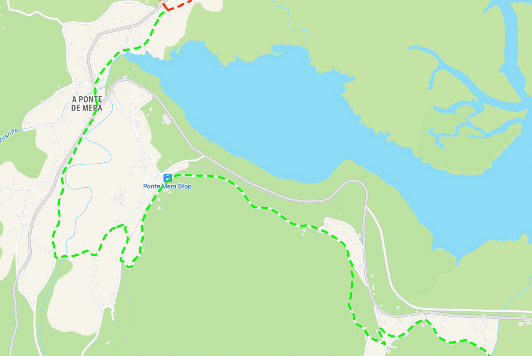
Stage 5 – Around Ponte de Mera
A small change before A Ponte de Mera (that routes you past a fountain, conveniently), and then a longer, looping change south of the train station. The best part of that longer detour is that it passes through a fantastic spot for camping–a covered wooden shelter with picnic benches and running water. In this map, the revised “official” Mar is in green.
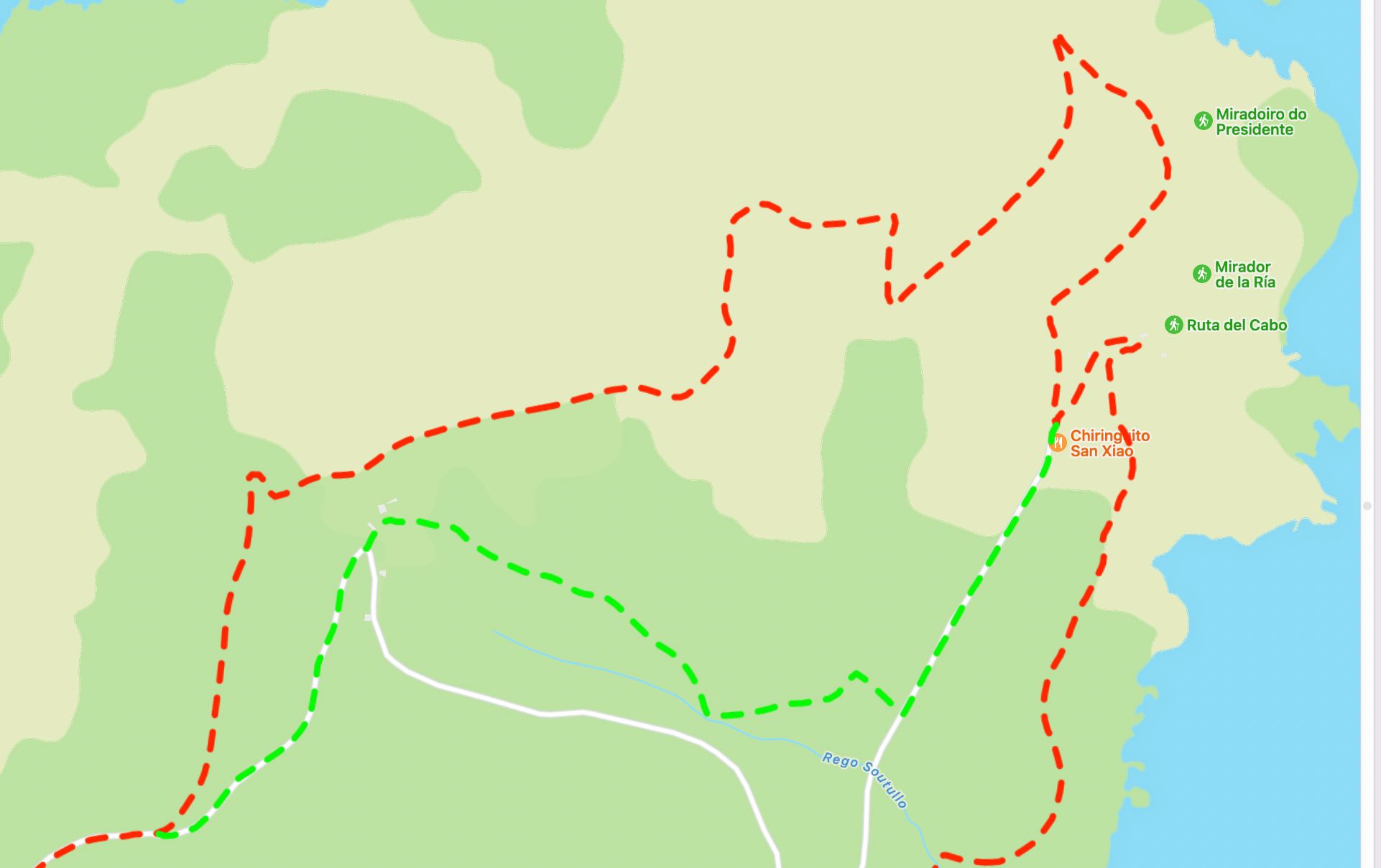
Stage 6 – Between San Xiao and Cabo Ortegal
There aren’t supposed to be any Camino del Mar arrows here, and yet they magically appear at the Ermita de San Xiao! The waymarking isn’t great, and the trail is overgrown in places, but it’ll save you a little walking if you don’t want to see the lighthouse at Cabo Ortegal. In this map, the “unofficial,” waymarked Mar is in green, while the “official” coastal approach is in red.
Stage 7 – Around Valdoviño
No need to go inland around the lagoon. You can just follow the beach straight across, even at high tide! Shaves off more than 4km!

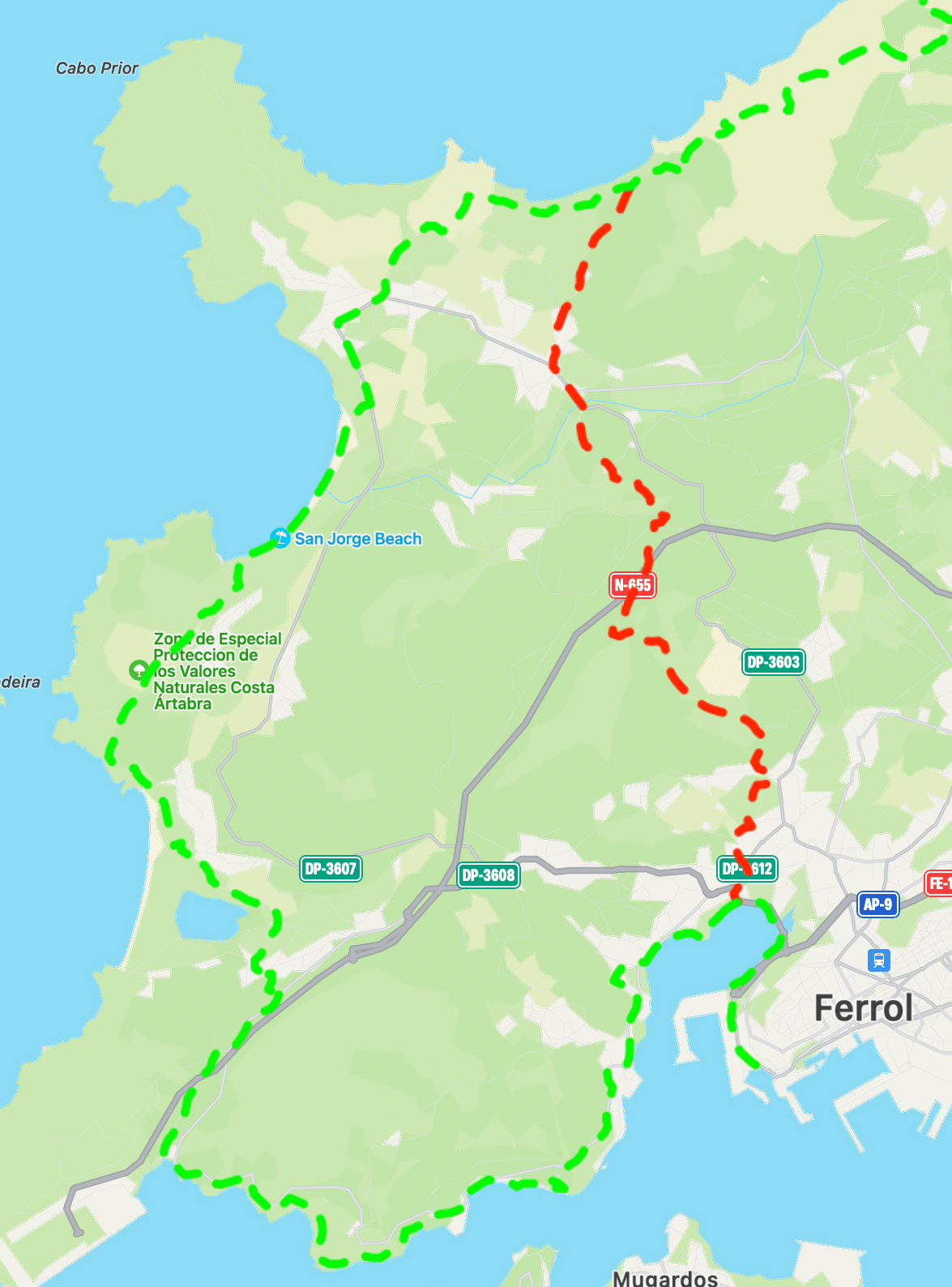
Stage 7 – A shortcut to consider, leading into Ferrol
I didn’t have the time to make the whole coastal approach from Teixido to Ferrol in one day, so I needed to find a way to trim some distance. The first part, heading south just after Praia do Casal, is completely unmarked–I just linked together dirt tracks and some paved roads. Conveniently, though, this eventually overlapped with part of the Senda Costa Ártabra. Paired yellow and purple arrows kicked in at that point, leading me to Ermita de Chamorro, which is a pilgrimage site in its own right, and then to the coast just before Ferrol. It was majority off-road and chopped off a full 16km! In this map, the suggested short-cut is in red, while the “official” coastal approach is in green.